
REGIONAL INDEX
REG-0007
UNMAPPED SEA
SIGNAL-ISOLATED OCEANIC REGION
Structural continuity remains unverified. Partial transmission persists.
CLASSIFICATION
Signal-isolated Oceanic Region
TOPOLOGY
Open Water / Abyssal Megastructure Field
SIGNAL CONDITION
Deep Harmonic Attenuation / Long-Range Transmission Loss
OBSERVER CONDITION
Extended traversal may produce directional uncertainty, delayed signal return, and incomplete environmental continuity.
ARCHIVE STATUS
Partial Transmission
KNOWN STRUCTURAL STATE
Subsurface Megastructures Detected
Verification incomplete.

ENVIRONMENTAL DESCRIPTION
Traversal across the Unmapped Sea does not maintain reliable positional continuity beyond the visible horizon.
Surface conditions appear environmentally stable during inactive observation cycles, despite unresolved structural activity detected beneath the water layer.
Large-scale reflective resonance fields intermittently emerge across open-water sectors without corresponding atmospheric origin signatures.
The Unmapped Sea presents as an expansive hydro-reflective boundary region containing submerged architectural systems, inactive convergence structures, and unresolved signal voids.
Observers report severe scale disagreement, impossible horizon depth, delayed acoustic return, and transient geometric emergence during extended traversal.
No verified terminal boundary or central origin structure has been documented within the mapped sea sectors.
TOPOLOGY / SIGNAL CONDITIONS
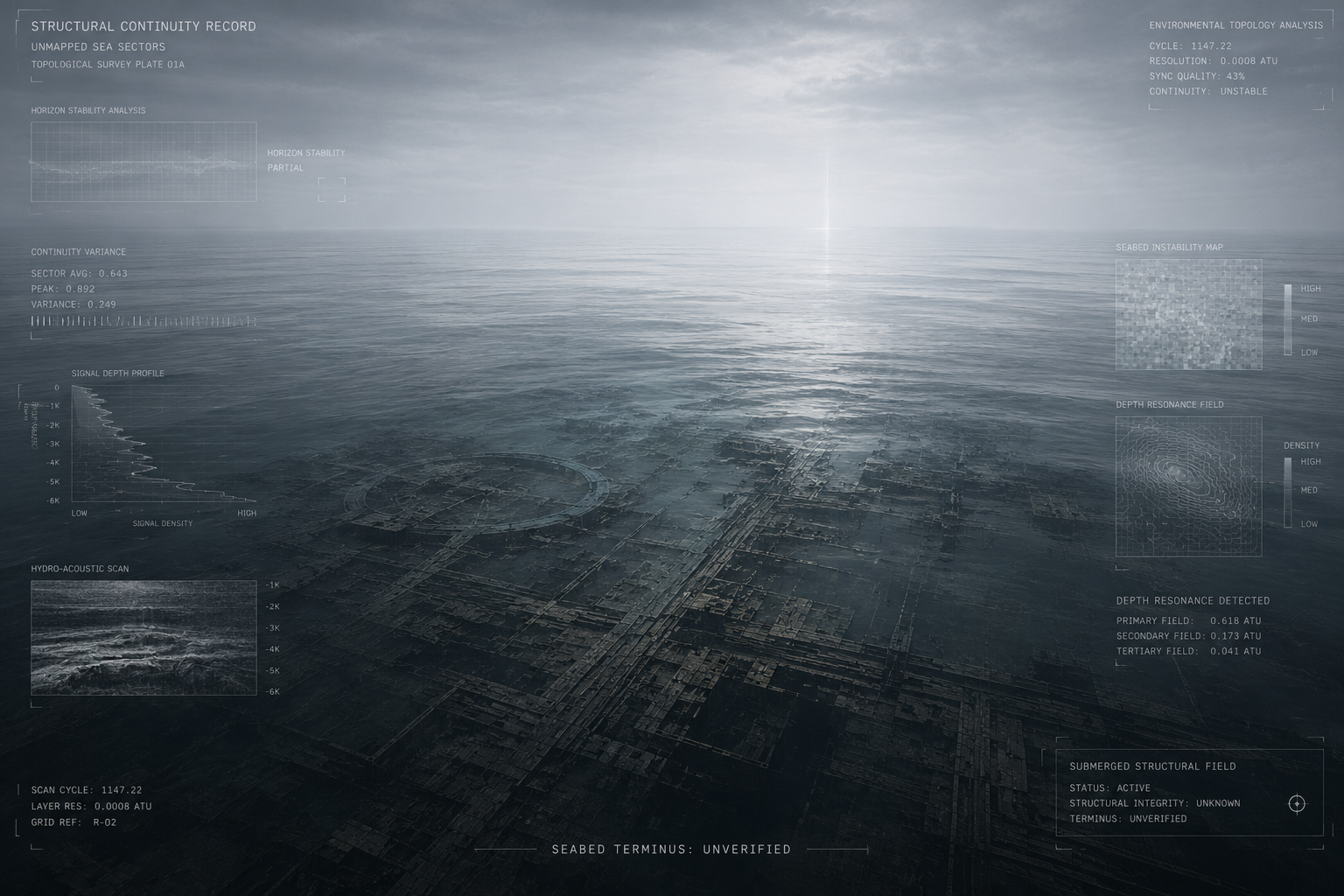
US-RCV-0001
RECOVERY ARCHIVE
Traversal across Unmapped Sea sectors does not maintain stable horizon continuity beyond verified visual range.
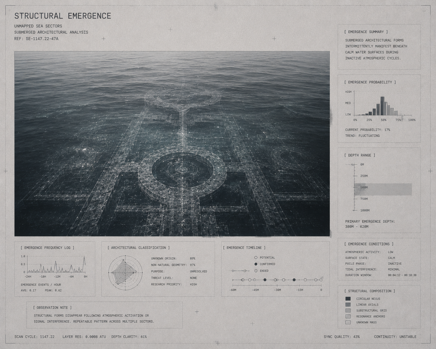
Reflective surface conditions intermittently conceal submerged architectural formations beneath inactive water layers.
Signal depth analysis indicates unresolved megastructural continuity extending below mapped oceanic sectors.
Hydro-acoustic telemetry persists despite the absence of verified seabed termination.
No confirmed terminal seabed boundary has been documented.
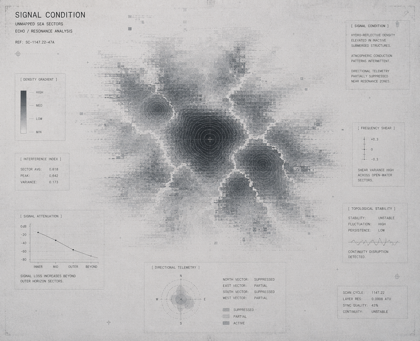
US-SIG-0088
SIGNAL RECORD
Hydro-reflective resonance density increases toward inactive submerged structural fields.
Low-frequency hydro-acoustic propagation intermittently persists across open-water sectors during passive observation cycles.
Directional telemetry becomes increasingly attenuated near unresolved resonance formations beneath the mapped sea surface.
Field continuity weakens beyond visual horizon limits despite persistent sub-surface signal detection.
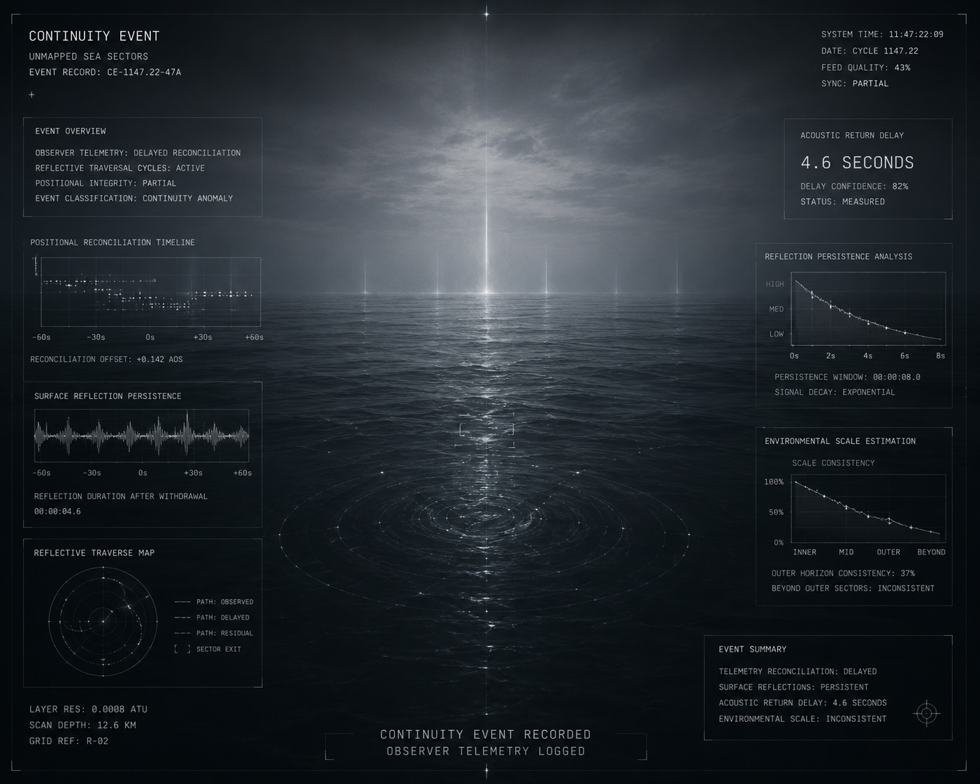
US-OBS-0001
OBSERVATION RECORD
Observer telemetry recorded delayed positional reconciliation following reflective traversal cycles.
Surface reflections persisted after observer withdrawal from active survey sectors.
Acoustic Return Delay
4.6 seconds
Environmental scale estimation became inconsistent beyond verified horizon thresholds.
Hydro-acoustic persistence remained detectable despite the absence of an identifiable transmission origin.
ASSOCIATED ENTITIES

THE ARCHITECT
Unresolved environmental restoration signatures remain intermittently detectable across submerged structural sectors.
Large-scale continuity architecture is theorised to extend beneath the mapped sea boundary despite the absence of verified surface structures.

VEYRA
Observer-alignment anomalies increase during prolonged reflective horizon exposure events.
Recorded traversal patterns indicate intermittent perception drift near unresolved oceanic continuity fields.

HORIZON DELTA
Threshold synchronisation phenomena are periodically observed above unresolved submerged structural networks.
Transient horizon displacement events continue to interfere with long-range environmental orientation across open-water sectors.
ANOMALY RECORDS
US-ANM-0001
HORIZON DISSOLUTION
Distant shoreline references gradually disappeared despite uninterrupted visual conditions.
No atmospheric obstruction was recorded.
US-ANM-0002
CARTOGRAPHIC DRIFT
Repeated survey passes produced conflicting coastal boundary measurements while local observations remained consistent.
US-ANM-0003
TIDAL DISPLACEMENT
Coastal water levels varied independently of recorded tidal cycles.
Reference markers remained fixed.
US-ANM-0004
REFERENCE LOSS
Verified navigational markers ceased beyond mapped survey limits without evidence of physical removal.
ARCHIVE RECORDS
US-OBS-0056
The sea continued beyond mapped atmospheric limits.
US-OBS-0057
Directional signal pathways emerged across the water surface during eastern traversal.
US-SIG-0007
Acoustic return originated before transmission.
DOCUMENT TYPES
OBS — Observation Record
SRV — Survey Record
RCV — Recovery Archive
ENT — Entity Encounter
ANM — Anomaly Record
SIG — Signal Record
ENVIRONMENTAL EVENTS
EVENT REGISTRY
US-EVT-0001
FIRST HORIZON LOSS EVENT
CURRENT STATUS
Stable
ASSOCIATED RECORD
US-ER-0002
SUMMARY
The first verified failure of observer horizon calibration during prolonged open-water traversal. Positional continuity could not be maintained despite stable environmental conditions.
US-EVT-0003
TELEMETRY NULL EVENT
CURRENT STATUS
Stable
ASSOCIATED RECORD
US-ER-0004
SUMMARY
Long-range directional telemetry failed beyond verified oceanic sectors despite uninterrupted observer traversal. Signal continuity could not be re-established.
US-EVT-0002
SUBMERGED STRUCTURE EMERGENCE
CURRENT STATUS
Restricted
ASSOCIATED RECORD
US-ER-0003
SUMMARY
Large-scale architectural formations became intermittently visible beneath inactive reflective sectors. No confirmed origin or structural extent has been verified.
US-EVT-0004
RESONANCE CASCADE EVENT
CURRENT STATUS
Restricted
ASSOCIATED RECORD
Unavailable
SUMMARY
Persistent harmonic resonance propagated through submerged structural layers during inactive atmospheric conditions. The originating transmission source remains unresolved.

STATUS
Verified
INDEX
REG-0007
REG-0000
REGISTRY
CONNECTED REGIONS
REG-0002
DREAMWELL BASIN
────────
REG-0008
VEIN CONVERGENCE
────────
REG-0013
BOUNDARY VERGE
DESCENT / EXIT